The river must be tamed – but not too much
-
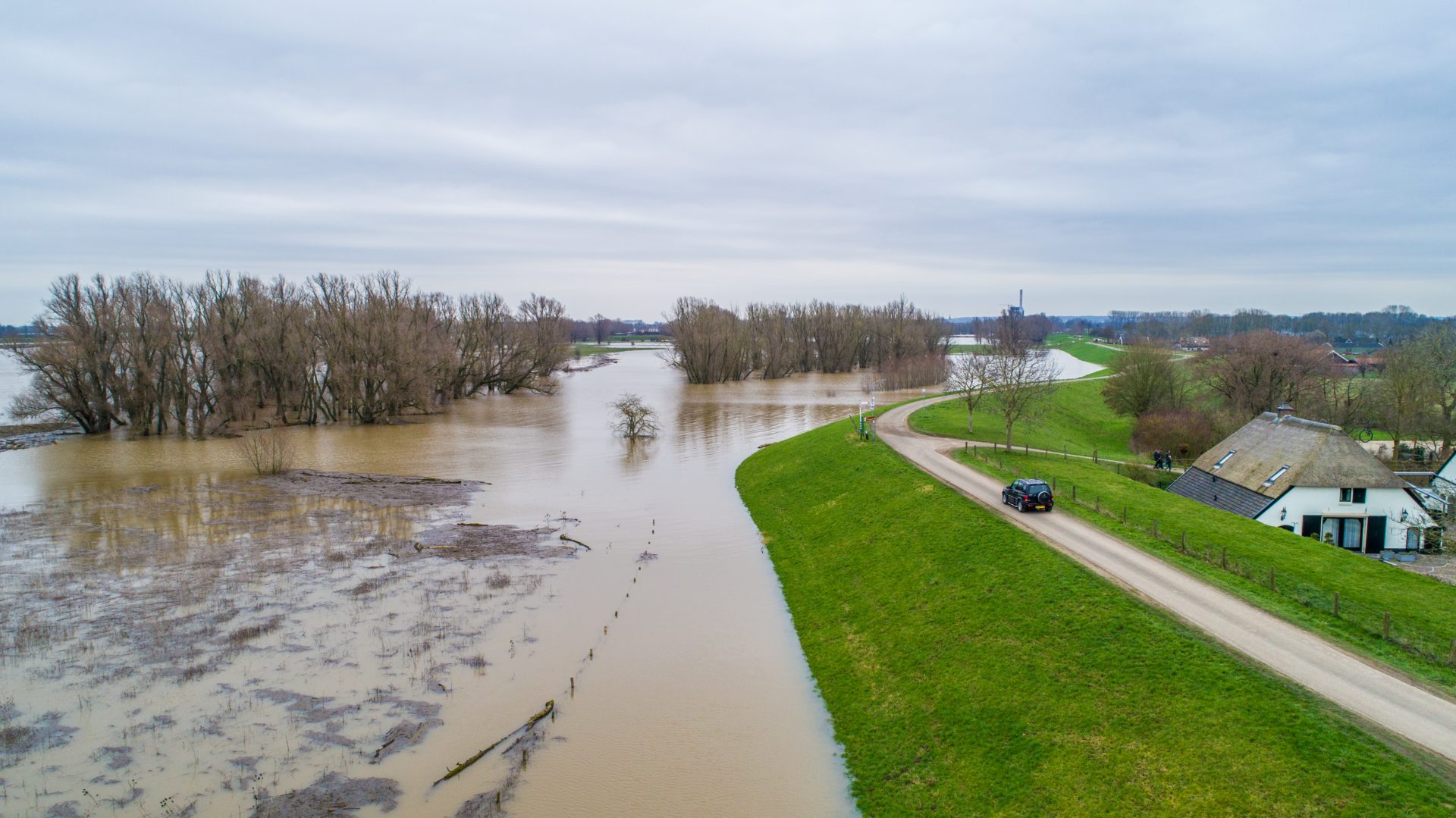
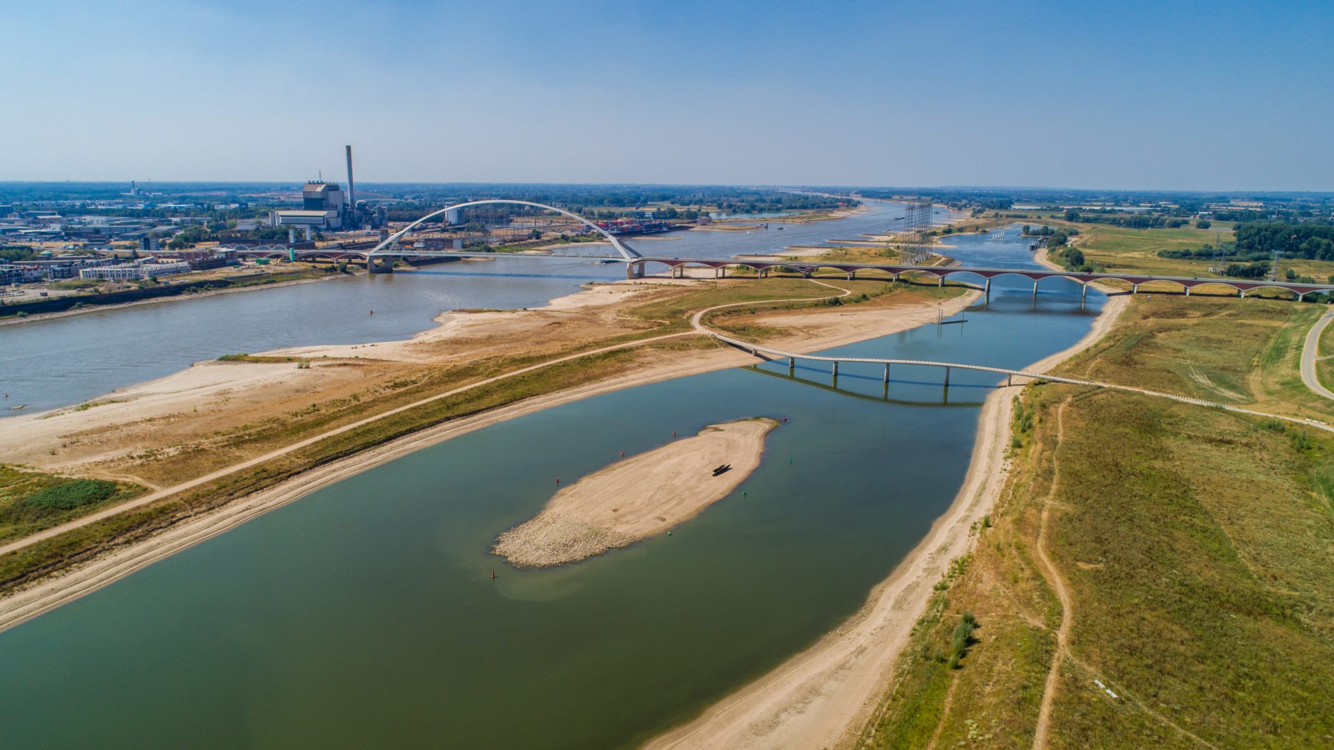 Shallow water, August 2018. Photo: Tom Hessels
After the flood disaster that nearly struck the Rivierengebied in 1995, the government took one protective measure after the other. Some dikes were raised by as much as one metre. Overkill, says the physical geographer; on the contrary, say the water authorities. ‘This kind of extreme situation could occur again tomorrow.’
The water is coming, warned historian and author Rutger Bregman in early February in a widely distributed pamphlet. “If we don’t do anything, the flood disaster of 1953 might happen again”, added de Correspondent.
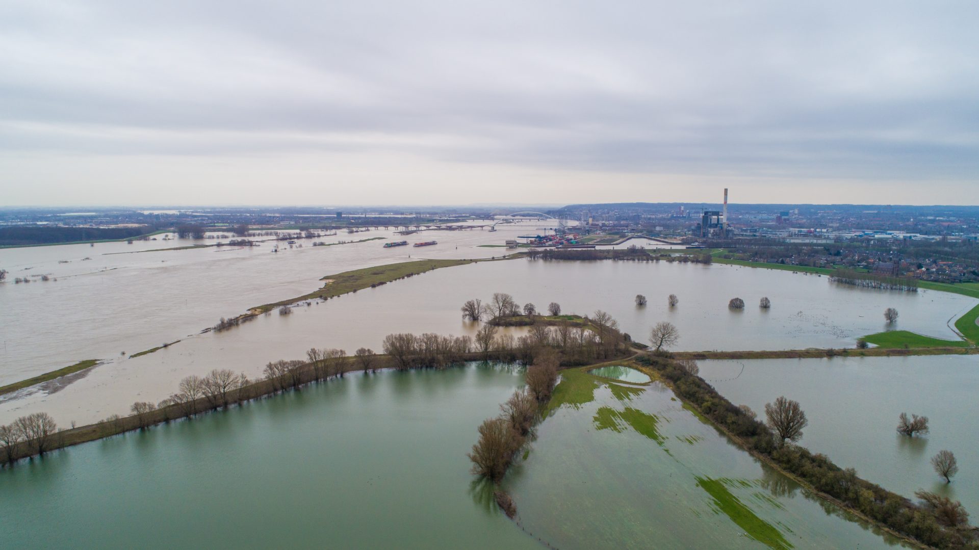
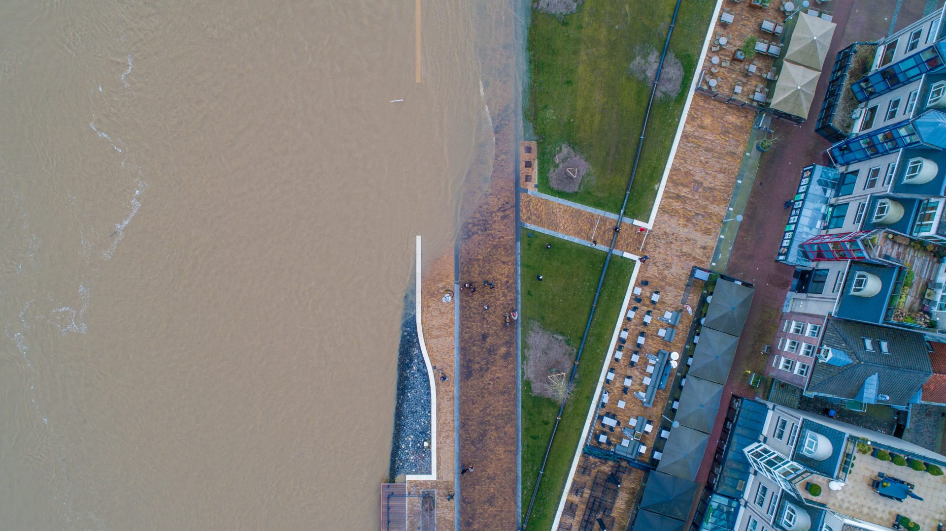
The water doesn’t just come from the sea; the rivers too form a threat for the Netherlands. Think of 1995, when part of the Gelderland Rivierengebied had to be evacuated because the dikes nearly collapsed. And more recently, in February of this year, the Waalkade was closed because of the rising water level.
‘Safety norms have become too strict’
And yet, not everyone agrees with Bregman’s urgent call for more protection against the water. Alphons van Winden believes on the contrary that we’ve gone overboard, at least as far as strengthening the river dikes is concerned. Van Winden is director of water consultancy agency Stroming, which was involved in building the side channel near Nijmegen. On the website waterpeilen.nl and in newsletters, he has for years discussed the water levels in the Dutch Rivierengebied, comparing them with historical data.
Physical geographer Van Winden is of the opinion that safety norms have become too strict, he explains in the living room of his house in Ubbergen on the lateral moraine. The walls are adorned with topographic maps of various parts of Europe, and the table in front of us is covered in sheets of paper with graphs.
Since 1995, he explains, there have been multiple rounds of protection works, from dike reinforcement to the creation of the side channel along the Waal (Spiegelwaal) as a flood catchment area. As a result, the chances of a dike collapse are now only once in 1250 years. Because the safety norms used were stricter with each round, we are now very much on the safe side, says Van Winden. ‘The side channel near Nijmegen is beautiful, and it works well – the water level upstream is approximately 35 cm lower. But now in addition to the extra safety offered by the side channel, a new round of dike improvement is underway, and it will again cost billions.’
Flood protection measures since 1995
The near-disaster of 1995 led to the formulation of the Delta Plan for the Major Rivers. The government had half of the more than one thousand kilometres of river dikes in the Netherlands raised – in some cases by as much as one metre – and widened. The result was that dikes met the norm of being able to handle a water volume of 15,000 m3 per second. When this criterion was increased a few years later to 16,000 m3, the programmes Ruimte voor de Rivier (Room for the River) and Maaswerken (Maas Works) were developed. Instead of creating even higher dikes, the river was given more room, by dike repositioning and the creation of side channels, for example near Nijmegen. In 2017 the water authorities once again raised the norms – not for water drainage, but for dike strength. As a result, dikes will once again be strengthened, a project that is to be completed in 2050.
He’s referring to the latest series of protection measures, which also take into account the condition of the dikes. The government decided on these measures after the dike shift in Wilnis in 2003, when an entire residential area ended up under water. Of course, it’s a good thing that we keep examining the quality of the dikes, says Van Winden, but the flood at Wilnis was due to an old peat dike settling because of the drought. ‘Here in Nijmegen the dikes are constructed of sand and clay, so we don’t have these kinds of problems.’
Low water problems
What’s more, water levels have not risen in the past few years, he adds. ‘Look,’ he points to one of the graphs on the table. ‘From the 1980s onwards, the yearly high water peak was increasing every year, so the dikes had to be raised time and again. But since 2003, these maximum values have actually fallen by approximately 10%. We are now almost at the same level as in 1985.’
He sighs. ‘Instead of investing in new dike reinforcements, we would be much better off putting our money into the main water channel – this is where the greatest challenges now lie. The river bottom is sinking steadily.’ Flowing river water is very powerful, explains Van Winden, think of the impressive gorge of the Grand Canyon. When this power is exerted sideways, the river meanders. In the Netherlands, this effect is curbed by placing breakwaters in the river. This fixes the water flow, but it means the water power can only be exerted in one direction: downwards.
‘There’s less melting snow these days’
The result is a sinking river bottom, which in turn leads to gas and electricity pipes that were initially laid in the river bed appearing on the surface. The same applies to the basalt blocks intended to reinforce the river bottom, for example on the Nijmegen Waalkade. When the water level is low, primarily in summer, this means ships have to transport much less cargo, or run the risk of ending up too low in the water. This is something we need to address, says Van Winden, for instance by raising the river bottom, or by placing breakwaters not perpendicular, but parallel to the dike.
The peaks in water volumes may be lower in recent years, but won’t they soon rise as a result of climate change? That’s a good question, says Van Winden. ‘Whether and how climate change will affect high water peaks in Europe is as yet very unclear. High water is primarily determined by the speed and direction in which rain areas move across Western Europe. Rain usually moves from North to South, which rarely leads to extreme situations.’
He explains that high water generally occurs when rain zones behave atypically and move in the direction of the river flow, towards the North. If this happens to coincide with melting snow from German low mountain ranges, then you get real extremes – like in 1995. ‘But there’s not a single indication that this kind of combination of circumstances will occur more frequently as a result of climate change. And there’s also less melting snow these days.’
Barriers
The current dike norms are certainly not excessive, answers Hennie Roorda, from the Rivierenland Water Board. Protection against flooding is about more than the odds of water rushing over the dike, says the Water Safety Councillor, an administrative position comparable to that of Alderman. ‘A dike can fail for other reasons, such as piping, which involves sand being flushed under the dike, so that parts of the dike can slide away. This is primarily a risk in the East of the Rivierengebied, where there are several sand layers in the substrate.’ To prevent piping, the water board takes measures such as digging special sheets under the ground, like in Opheusden, and building barriers of coarse sand.
Even though water levels haven’t risen in recent years, Roorda believes we have to remain vigilant. ‘You can’t base your water safety programme on data from the last twenty years. Another extreme situation could occur any day, and we have to be prepared. The Dutch water authorities base themselves on models by the KNMI and IPPC, which are updated every few years.’
Roorda is certainly not trying to deny that there are other problems, like sinking river beds that form an obstacle for shipping. These problems are also being addressed, she explains, by a programme known as integrated river management. This collaboration between local water boards, Rijkswaterstaat, the provincial government, municipalities and nature conservation organisations is intended to keep the river area safe, green and navigable. ‘These dialogues are increasingly gaining momentum, but there’s certainly still lots of room for improvement.’
She believes citizens also have an important role to play. In these days of climate change, it’s time the Dutch became more aware of the fact that they live in a river delta, she says. ‘We are the drain or Europe, so surely we want our government to take serious climate measures! In that sense ‘1995’ was a good wake-up call. Give us today our daily bread, and from time to time the threat of a flood.’
Radical protection idea: flooding provinces
When considering water safety, experts and researchers don’t look only at the rivers, but also at the rising sea level. Geert van der Meulen, researcher at Delft University of Technology, investigated an extreme scenario: flooding parts of Zeeland, Friesland, Groningen and Zuid-Holland, thereby relocating 1.7 million people.
‘As part of that research project I designed a proposal for a kind of hybrid Netherlands that would be able to deal with a sea level rise of ten metres,’ says Van der Meulen. ‘This would require us to give up areas of land.’ The plan elicited many critical responses, especially from the areas to be flooded. Van der Meulen argues that although this is very understandable, it’s partially due to a lack of imagination. ‘Those areas of land wouldn’t be turned into ponds; you’d still be able to use them. But for many people, this is a bridge too far.’
For example, areas of land wouldn’t have to be flooded permanently, but only for part of the year. ‘If a park is, for example, mainly used in summer, you might decide to flood it in winter. Or we could raise the infrastructure, or make some parts of it floating. Technically, so much is possible.’
The problem is not the technology, but society, says Van der Meulen. ‘There’s a lot of resistance to any adaptation to climate change or a potential sea level rise, because the measures give us little satisfaction in the short run; we do it for future generations. This kind of social reluctance is very difficult and slow to break through.’
And this while there is no better country than the Netherlands to address this issue, he says. We have the finances, and the technology is available. ‘But we’re so used to dry land. If our cellar gets flooded, we make an angry phone call to the municipality, but we aren’t expected to do anything ourselves. It’s hard to sell to people the idea that they have to make sacrifices to ensure future generations can continue to live in the Netherlands.’